
Hamburg Township Street Directory Search
A useful street search has a clear order. An address is the starting key, but the parcel identifier and legal description are often stronger links across systems. The county tools distinguish what is mapped, assessed, or recorded. Michigan voter information has a separate public-record route, and a historical directory can be the only dated household clue for an older address. Treat each return as evidence of the relationship that source actually records.
- Check the full delivery address through the USPS ZIP Lookup, including unit and postal city when applicable.
- Search Livingston County Property Search by address number and street, then narrow to Hamburg Township and retain the parcel result date.
- Use the GIS viewer to confirm the parcel’s mapped situs, PIN, acreage, road placement, and nearby parcel geometry.
- Search the Register of Deeds by a recorded party or legal description, then work backward through instrument references and Liber/Page citations.
- For a dated household clue, test directory, census, obituary, atlas, or newspaper material without equating it to a modern parcel record.
Note: A long road should be searched in small number blocks, because the county property system caps both ranges and returned results.
Hamburg Township Address Normalization
Write down the number, prefix, street name, suffix, unit, postal city, state, and ZIP exactly as supplied. Then create a normalized version for county searching. USPS offers By Address, By City and State, and Cities by ZIP modes. Its address form separates street address from apartment or suite information and warns that a recommended city name can differ from the place name used locally. A ZIP result establishes delivery information, not that any person is at the address.
That postal distinction is important in Hamburg Township. Research identifies Hamburg Township-serving postal labels such as Brighton, Hamburg, Lakeland, Pinckney, Whitmore Lake, and Howell. None is a substitute for the township or a parcel boundary. Preserve both the situs township and the USPS mailing city in notes. A missing unit, wrong road suffix, or postal-city assumption can make a county address search look empty when the parcel is present under a different formatting choice.
Hamburg Township Property Search
Livingston County Property Search combines Treasurer and Equalization data. It accepts owner information, parcel number, property address number or number range, street name, and a City/Township/Village selection. The controls also distinguish Real, Personal, and Other property, plus Active and Retired parcels. Search by number and street before using a broad owner name. The county warns that local governments update owner and address data, so a return should be checked against the local unit when current information matters.
The Hamburg Township portal returns no more than 50 results. A From and To address range may span no more than 1,000 numbers. Divide a long Hamburg Township road into smaller blocks, keep a log of the ranges, and compare the returned Hamburg Township parcels with GIS rather than assuming a first page is a complete street list.
| Property Search field | Street-directory use | Portal rule |
|---|---|---|
| Type of Property Search | Choose Real, Personal, or Other | Optional radio control |
| Type of Parcel Search | Choose Active or Retired Parcels | Optional radio control |
| Owner Last Name / First Name | Check a parcel-owner spelling | Neither field is required |
| Parcel Number | Search the displayed dashed parcel number | Uses county prefix 47 plus parcel boxes |
| Address Number / From-To | Search one address or a street segment | Range limit is 1,000 numbers |
| Street / City-Township-Village | Pair road name with Hamburg Township | Results limited to 50 |
Start at the Livingston County Property Search rather than relying on an unlinked address listing.
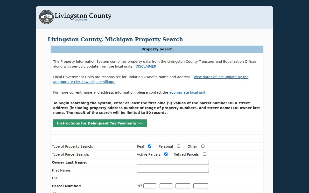
The search screen shows why an address number, street name, parcel, and township filter should be recorded as separate query choices.
Hamburg Township GIS Street View
The Livingston GIS Parcel Viewer is the spatial companion to Property Search. It searches address components separately: Address Number, Prefix, Street Name, and Suffix. Parcel ID queries omit county code 47 and retain dashes. Owner suggestions accept First Last, Last, First, or Last First, while subdivision or condominium names provide another entry point. Broad queries show up to 15 suggestions, so a missing name from that list is not a no-record finding.
After selecting a Hamburg Township result, use the looking-glass action to open a pop-up with Parcel Identification Number, Property Address, Acreage, and a link to the property summary. Parcel and road layers help locate adjoining parcels. The print menu can create PDF, JPG, or PNG maps with layout and orientation choices. Measurement and drawing tools help with map context, but the map is not a survey, a deed, or proof of occupancy.
Owner, Mailing, and Situs
Hamburg Township street records often put several addresses beside the same parcel, and they should not be collapsed into one conclusion. A situs address is the physical property location. A tax or mailing address identifies where a bill or notice is sent and can be off-site. An owner name comes from a property or recorded land record. A deed identifies parties to an instrument, which can include a trust, estate, corporation, representative, or multiple co-grantees. An occupant is a different question.
BS&A Hamburg Township is a useful secondary route because its landing page points to property, tax, permit, utility, and delinquent-personal-property functions and accepts address, name, or parcel searches. Its detailed dynamic forms were not captured, so it is a lead to validate with county GIS, Treasurer/Equalization, or the township office. A permit applicant or contractor may also differ from the owner and the person living at the property.
Hamburg Township Address Records
Hamburg Township address-keyed sources work best as a chain, not as replacements for one another. The parcel number connects Property Search and GIS. A legal description connects the parcel to older deeds. A street and house number can lead to dated directories, census, obituaries, permits, or township meeting references. Record whether the source is current, historical, mapped, recorded, or a request-only path.
| Address record | What it can show | Custodian | Access channel |
|---|---|---|---|
| County Property Search | Owner, parcel, and property-address lead | Livingston Treasurer and Equalization | Free portal with 50-result cap |
| GIS Parcel Viewer | PIN, situs, acreage, parcel geometry | Livingston GIS | Free viewer and map export |
| Recorded deeds | Grantor, grantee, legal description, document reference | Livingston Register of Deeds | Free index; images, counter, phone, or mailed copy |
| BS&A and permits | Property, tax, permit, or utility research lead | Hamburg Township / BSA route | Linked search; detailed fields not verified |
| Qualified Voter File | Lawful public-file fields, subject to redaction | Michigan Department of State | FOIA request path |
The street name is useful for finding a group of parcels. The PIN and legal description are safer links when a road name, number, or postal city changed over time.
Hamburg Township Deed Chains
A Hamburg Township deed trail begins with the current parcel and legal description, not just a name. Livingston County’s public deed index is free to search. Documents recorded since November 7, 1980, or Liber 1000, are generally indexed and imaged online. The older record path is uneven: Libers 1-26 and 192-1004 can have images without a computer index, while Libers 38-191 are hard-copy only. Grantor/grantee indexes reach back to the beginning of county recording, and tract-index books use the legal description.
Record each instrument type, recording date, party relationship, Liber/Page or document number, and the next prior party to search. The county does not abstract title or certify that a parcel owner is current, and unrecorded interests can exist. When online indexing stops, use public self-service computers, tract-index books, a quick phone or in-person search, mailed copies, or the county’s paid report route. A standard image is $1 per page plus convenience fee; certified copies require mailing.
See the Livingston recorder checkout screen for the instrument and copy choices.
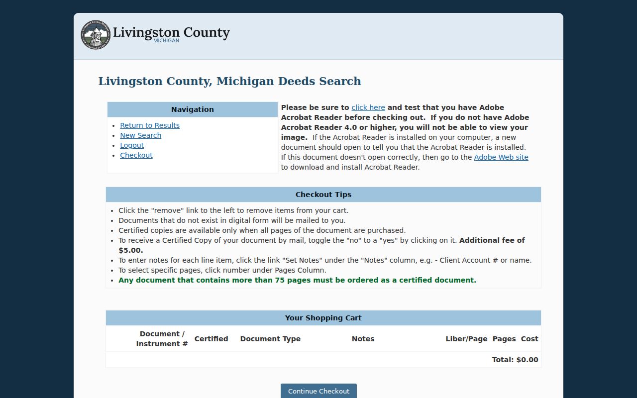
The checkout view reinforces that an index result, an ordinary image, and a certified copy are distinct parts of the deed-access process.
Hamburg Township Address Assignment
Livingston GIS assigns addresses for Hamburg Township after the township land-use prerequisite is met. The application calls for ownership proof, a current parcel number, a site plan showing frontage, property lines, driveway, and road, plus a Livingston County Road Commission driveway permit. Acceptable ownership evidence includes a warranty, quitclaim, or executor deed with full legal description, a land-contract record, or a current tax bill with owner and legal-description information.
Hamburg Township applicants also provide the closest existing addresses on both sides and across the road, with distances. The driveway determines the number and road. GIS lists a $20 fee per address and a 4-5 day target after required materials and payment, with issuance by email. Those requirements can be useful historical clues, but no historical address-assignment series was found in the research.
Hamburg Township Numbering Gap
No official street-renumbering or annexation timeline for Hamburg Township was located. Do not state that an old Hamburg Township number equals a modern address without supporting evidence. A rural deed may have only a section, lot, metes-and-bounds description, road name, or neighboring landowner. For Hamburg Township, the correct bridge is the tract index, plat or atlas map, parcel geometry, and dated source notes, not a guessed renumbering.
Hamburg was organized in 1835 and Genoa separated in 1837. Earlier records can use a later-changing township boundary or a neighboring jurisdiction. If an address or road name does not fit, ask GIS or the township for historical addressing, subdivision, road-name, or map material, and check township meeting records and Howell Archives catalog leads. Label any parcel-to-address connection as inferred until a primary record confirms it.
Note: The absence of a renumbering file is a documented research gap, not proof that a street number never changed.
Dated Street Clues
When a current Hamburg Township address trail reaches an older period, use dated sources rather than a modern search result. The verified Livingston County Directory for 1873-74 and Howell City Directory for July 1915 are leads, not guaranteed Hamburg Township household lists. A directory entry may identify a head of household, business, street, and occupation in a publication year. The Howell volume can show a business or mailing relationship to Howell rather than a Hamburg Township residence.
Howell Carnegie Archives holds directories, microfilm, abstracts, maps, cemetery records, yearbooks, and newspapers through an appointment process. The 1895 Livingston County atlas and combined 1875, 1895, and 1915 atlas can supply roads, sections, and landowner context. The Hamburg Township city directories resource explains how to read those historical entries without treating them as a complete roll.
Hamburg Township Voter Limits
Michigan’s Qualified Voter File is not a free-form Hamburg Township street roster. The public-record route has geography, delivery, and voter-history choices, and it withholds sensitive fields. Phone, email, driver-license or state-ID data, signature, month and day of birth, and the application-receiving office are not public. Residential address and year of birth are described in the request material, subject to the controlling rules and redactions.
Use the Michigan Department of State path for lawful voter-file requests, and do not treat a Hamburg Township parcel without a visible voter record as vacant. An absence can reflect a redaction, eligibility issue, data update, or a different record relationship. Michigan does not use ordinary party registration, so a street result should not imply one.
Hamburg Township Street Directory Limits
A Hamburg Township street directory can organize parcel and address records. It cannot produce a complete list of every person associated with every house. Owner, tax recipient, recorded party, voter, permit applicant, historical householder, and occupant are not interchangeable. A map can show adjacency but not a surveyed boundary conclusion. A court or vital record has separate access rules, and a missing result may be a protected or incomplete record rather than a negative fact.
- Parcel
- A county land-unit reference used across assessment, GIS, and deed research.
- Situs address
- The physical property location shown by a parcel system.
- Plat
- A recorded map that depicts lots, streets, or subdivisions.
- Criss-cross directory
- A street-ordered directory that can lead from an address to a dated household entry.